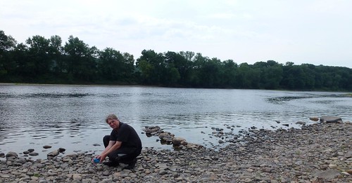
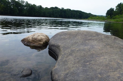
We meandered along the Delaware River for a ways. It was mostly quiet, on high alert for deer. Stopping briefly to see the river and

It's time to start our day in earnest though, realizing all of the miles we have to go. I put the destination into the single working GPS, zooming out a little to verify direction. Quick glance showed it looked fine. Right...
We didn't miss the fact that we seemed to be hitting too many toll roads. We just figured the GPS is taking us along some smaller roads before getting to the big interstate. We didn't miss it, we just didn't think too much on it. We didn't miss the fact that even for toll roads, these lanes had lots of potholes, weeds, and litter. Again, we didn't overlook it, we just didn't think of the importance of it.
It finally intruded into the forefront of our brains when we saw huge bridges crossing large bodies of water, a few pushes of the zoom out button, on the working GPS, showed us on the outskirts of Philadelphia.
PHILADELPHIA???
WTH???
We were supposed to be going through Harrisburg, PA. No. Where. Near. Philadelphia!!
I've been fighting with the temperamental "I'll work when I want to GPS." I'm starting to have my own temper tantrum to match its. And I realize that I had set Oilburner's GPS to Port Royal, VA for our destination. Not Front Royal, VA.
Port Royal...

Front Royal...

Port Royal...

Front Royal...

PORT ROYAL...

FRONT ROYAL...

Port Royal, VA IS NOT Front Royal, VA

Oh...this isn't good. We stop at a Subway to reassess the situation and determine our options from here.
I'm beside myself wondering how in the world I could have made this mistake. Oilburner is trying to calm me down, because he had also looked at the statistics for the route and felt they were good too. From Matamoras, PA it is 291 highway miles to Front Royal, and 317 miles to Port Royal. Not enough distance or time difference to raise any red flags, especially adding our time on the back roads.
It doesn't make me feel any better though...

Now we have to decide where we go. Do we continue on with the original plan of Shenandoah? Or regroup and head somewhere else? Discussing over lunch and feeling calmer, Oilburner still thinks Front Royal is feasible. We both still want to see Shenandoah and the Blue Ridge Parkway.
The kink in the plan is that to get there we have to skirt Philadelphia, Baltimore, AND Washington D.C. During rush hour times. I won't ride in Atlanta during rush hour if I can help it. Why the heck would I want to hit Philadelphia, Baltimore, AND D.C. all in ONE day??

Argh...
We tighten our belts (OK, maybe Oilburner loosened his since we had just eaten), steel our nerves, and ready ourselves for battle.
Not too far down the road I have the pleasure of watching accident occur in the lane next to me. I've left a decent space between me and Oilburner since I don't want people losing me in the "blind" assessment of seeing a "single" rider. If people want to suddenly dive in between us, I'm going to give them the room. All this means is that Oilburner didn't see or hear a thing.
Of the two lanes to my right, the far one is being coned off for construction. A big semi-truck was merging into the lane on my right (his left) without seeing the very low profile vehicle hauling trailer. The semi-truck smacked into the last three feet of the trailer, skipping the trailer into my lane about a foot. Luckily nothing else occurred, the truck and trailer recovered quickly and the semi slowed down rapidly. I had a second to survey the damage to the trailer. Wow! Imagine thick steel beams, like a car frame, bent up into a pretty wing shape.
Thankfully that was only the second worst thing to happen today. (I still maintain the Port Royal fiasco was the worst.) The rest of the day only held heavy traffic and a few backups. McDonald's ice cream and Frappes cooled off those slights.
It wasn't a much longer day than expected, we just traveled the sides of the triangle rather than the hypotenuse. But it all worked out. And bonus, we did see the outskirts of towns I never expected to even be near on a motorbike. The hotel was new and luxurious. The attached restaurant was a Houlihan's serving alcohol. But most importantly, I can put West Virginia on my map of states ridden in. :) It wasn't on our radar to be there. Score!
I never have never trusted my GPS and I never will. I've grown up riding around with bunches of maps on top of my tank bag. I only ever got lost once and it was only by about 500meters till I thought it was the wrong way. I've always looked at maps to see where i'm supposed to be going. Thats what I hate about GPS systems, you put the address in and hopefully it will take you to the right place, you don't really know where its taking you unless the Kms looks like far to much and then you look into it.
ReplyDeleteI do agree that they are not to be trusted. We have encountered situations where are two units couldn't even agree on the same route. It's was my error pure and simple...port vs front... ;)
DeleteSince this was 300 miles away, I didn't zoom into the destination like I would if it had been an address. Luckily we rarely have to rely on the GPS, choosing to go by desirable road over forced direction. But I did learn my lesson in this one. :)
Lori:
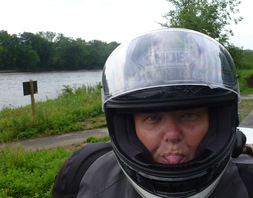
ReplyDeletethere is sooo much to like on this post. I liked your tongue, I liked your smirk and I like that you actually made a MISTAKE. I know, the GPS always suggests a destination city/town and you just clicked the wrong one. I like your unplanned adventures. Can't wait to ride and get lost with you two.
It looked like a relaxing stop by that river, but it didn't look very warm that day, perhaps Muggy ? At least you arrived and had a luxurious place to stay
bob
Riding the Wet Coast
My Flickr // My YouTube
As I wrote to chillertek...this one was purely my mistake as I had to manually type in "Port" instead of "Front". :( I was tired and just didn't think of the name difference. But hey, one mistake in 3500 miles...those aren't bad numbers. ;)
DeleteI'll see what I can do to get us lost when we have the chance to ride... Shouldn't be too difficult.
And the day along the river was warm and muggy. It had rained the night before and the humidity was hanging around.
Sides of a triangle, hypotenuse, next you'll be riding a parallelogram.
ReplyDeleteDo we need to get you some reading glasses for punching information into the GPS? Can you at least call it a happy accident or was it way too far off for that?
I like Steve prefer a paper map. We usually have them stuck in the luggage some where and rely on the GPS for giving us restaurant and Starbucks locations.
LOL...parallelogram. I can't even spell it on my own!! ;) Reading glasses, no. Memory improvement vitamins, yes.
DeleteNormally, we love to stop at the visitor centers across each state line and pick up the wonderful free road map they have for the state. It became cumbersome this time since many weren't stocking them unless they were manned. And they weren't always manned when we came through.
I'm generally fine as long as I am pointed in the correction direction. I'll figure out the way from there. Hehe. Funny, we started relying on the yelp on the iPads for restaurants on this trip. That is...if it wasn't a Subway in transit.
A couple of weeks ago when I was in PA, I was surprised that the GPS routed me through Philadelphia instead of using the wealth of tiny little roads that seem to run everywhere. I think it automatically assumes that you want to be on the highways and toll roads....
ReplyDeletePaper maps are great for planning or when you have someone else looking at them while you're trying to keep from becoming another traffic statistic. I don't think I'd want to ride in any of those east coast cities on a bike. It's bad enough in a car (but much worse in a cab)...
Yeah, I think the algorithm is for quickest route...that doesn't having you going the smidgen of amount backwards. The darn thing will route you on the strangest route instead of taking you back 3 minutes. Did you ignore your GPS? PA has some of the best smaller roads! Wish I had seen more of them. Though what I remember from 5 years ago pulling the trailer was the abundance of frost heaves...
DeleteI think the only way to get through some of these cities is if you have the GPS screaming directions in your ear. It's difficult to try and look at the GPS and the road signs. Invariably the GPS says the name is the road number, yet the road signs have the name. Or vice versa. Never match... In some cases we had to actually figure out which street we needed to turn on by zooming in and seeing when we were going to "cross" it. But no...no cab rides!!! I'm glad you survived.
When I left PHL, I had only a hint of where I wanted to go and followed the GPS. I was surprised to see the highway signs telling me that I was headed back to Philadelphia. I was running late so I just kept on going.
Delete1. Never fully trust the route picked by your GPS
ReplyDelete2. Dang computers, doing exactly what you asked of them.
Dom
I don't even know how to use a GPS. Thankfully I follow hubby. He's pretty good with directions. Love the faces you captured!
ReplyDeleteSeriously..u had a GPs and still &$%^ it up...oh dear....I hope we get to Savannah and not some obscure place in the south where inbreds are normal and Mcdonalds really is a farm!
ReplyDeleteDear Steel Cupcake:
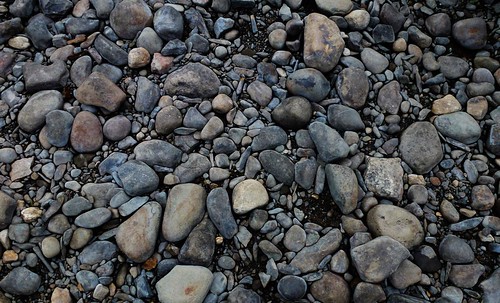
ReplyDeleteI looked at the picture of the Delaware River and started to laugh. Did it ring a bell? A placid waterway, full of canoes, with a gravel bank that crunched underfoot when you pulled up? (Chapter 16)
Here is my process for using a GPS.
1) Plot route on a large type map, from American Map, made for old people who are going blind.
2) Measure distances and picturesque routes.
3) Memorize 100-mile stretches.
4) Use GPS to confirm that I am following the map in my head.
5) Question all radical changes suggested by GPS.
6) When the Garmin works, it is incredible. When it fucks up, you could end up anyplace.
I used to travel up and down to Lake Placid, New York sometimes twice a week, for 15 years. This is an 8-hour run. I learned every variation of the route. When buddy Mike Cantwell rode his K75 down, I gave him exact directions. He got off the interstate in Princeton to follow the GPS. It added 3 hours to the ride, while shortening the route 25 miles.
Great story. I loved this. What is it about Bob Skoot and your tongue?
Fondest regards,
Jack/reep
Twisted Roads
You never appear to be at a loss for a good ride. How does that happen???
ReplyDeleteWow! That adventure had gone really serious. Well, the best thing is that your motorbikes did not experience any complications and not one was harmed during the very long travel. I’m glad you were able to handle the whole situation well and that you got back on track safely.
ReplyDeleteClare Westby